Pilliga Forest (NSW, Australia)
Pilliga Forest is a large forest in central north New South Wales, about three hours west of the large regional centre of Tamworth by road. The forest is made up of multiple state managed parks, and covers an area of about 5000 hectares, double the size of Sydney. The Pilliga Forest is in the land of the Gamilaraay (also known as Gamilaroi or Kamilaroi) people, who are the original Indigenous inhabitants of this land. Evidence of the long-ranging presence of the Gamilaraay people in this area is seen in the archaeology distributed across their country, including in the Pilliga Forest.
Due to the continuing ban on international travel for Australians and restrictions on interstate travel, a country roadtrip through NSW in late October seemed like a great opportunity to get out of the busyness of Sydney and explore some areas of the state that we otherwise may not ever have had the chance to travel to.
Pilliga Forest Discovery Centre
The Pilliga Forest Discovery Centre is located in the small town of Baradine, west of the Pilliga Forest. The town is home to less than 600 people and is the sort of place where there are no food options open after 7pm so forward planning is required. The centre is open daily from 9am to 4pm and, despite its out of the way location, it is well worth a visit prior to entering the forest itself. The discovery centre has an interesting collection of preserved native fauna found in the forest and information about the Aboriginal people of the area.
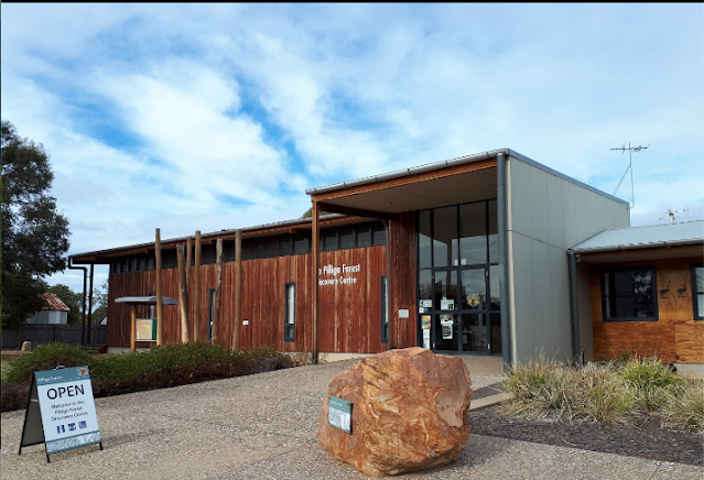 |
| Christine Scott, Google Maps. |
Sculptures in the Scrub
Sculptures in the Scrub are a permanent art exhibition that has been installed along a walking track in the scrubland of the Pilliga Forest. The sculptures are located along a 3km return loop walking track and is a relatively leisurely 1-2 hour walk, and parking and picnic areas are located at the start of the track.
The first part of the walk takes you up a number of stairs to a raised cliff path with views out over the area. The sculptures along the path are by modern artists who have been influenced by the rich Aboriginal culture of the region, displaying themes of inter-generational knowledge and kinship, spirituality, and technology. The artists have collaborated with Aboriginal elders and young people in the area to demonstrate past and contemporary aspects of Aboriginal culture and connection to land here.
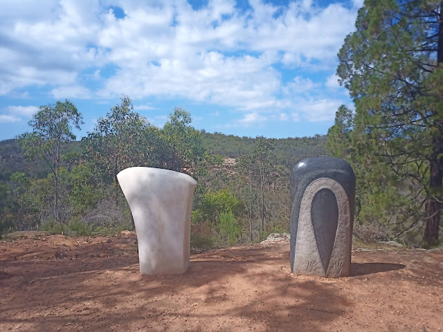
This sculpture below represents stone axeheads of both Aboriginal (right) and European (left) cultural traditions, highlighting similarities and differences in an emblematic element of both cultures.
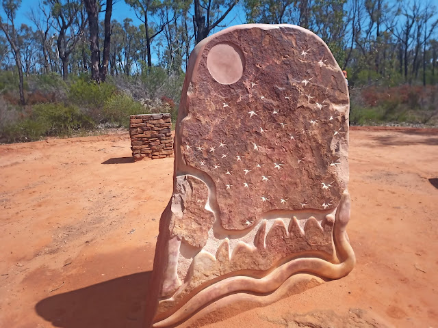
This sandstone sculpture shows the night sky and represents Dreaming traditions of the local people.
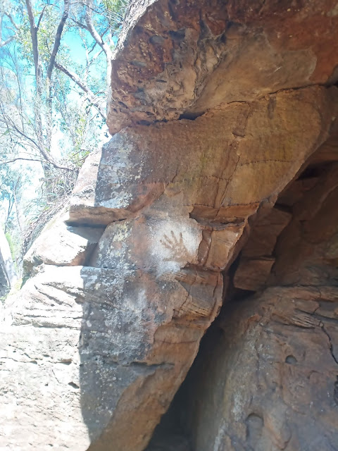
After finishing the sculptures section of the track (which included the above sculptures along with others) and heading back down a path, the last portion of the walk is through the Dandry Gorge. Here you can see an Indigenous hand print on the side of one of the caves in the gorge.
From the gorge you can look back up at the sandstone cliff where the sculptures are located. The walk through the gorge, filled with flowers and plant life in spring, leads back to the start of the trail and to the car park.
Salt Caves
Back on the No. 1 Break Road heading east, a left turn to a side road provides access to the Salt Caves. From the Sculptures, the Salt Caves are about an hour drive. Here you can find another picnic area. The caves themselves are no longer accessible for visitors due to widescale damage and collapse, but were once used by the local inhabitants to preserve their meat.
Despite the unreachable caves, this spot is a visitor attraction due to the presence of a 100m tall steel fire tower that has been constructed and reconstructed over the years. A short 100 metre bushwalk leads to the base of the tower and, taking the many steps up, leads you to an incredible view over the entire forest and beyond. As someone who is scared of heights, being able to see through the platform to the ground well down below was not the most comfortable experience, but the far reaching view was worth it. Points of interest in all directions, including the nearby Warrumbungles and Kaputar National Parks, are identified by a sign at the top of the tower.
Sandstone Caves
Heading to the Sandstone Caves takes you back onto No. 1 Break Road all the way to the east, followed by a right turn onto Newell Highway. Following the highway for a few kilometres, the entrance to the Sandstone Caves is a left turn marked by the sign Yaminba Trail. Here you can park your car and take the 1.7km walking trail loop to see the sandstone caves. This is about an hour to an hour and a half's walk and involves a few steps and inclines.
The Sandstone Caves were used for shelter by the Gamilaraay people and, in addition to interesting sandstone formations from weathering and water erosion over the years, archaeological evidence of the local Aboriginal people are also visible here. Like the sandstone cliff and gorge on the Sculptures in the Scrub Trail, the sandstone here has been formed from ancient volcanic activity. A short walk through the trail in scrubland leads you to the caves.
These caves are of strong significance to the local Indigenous people, and archaeological remnants of human activity over thousands of years can be seen along the trail. A guided tour of the caves with a local Aboriginal Discovery Ranger can be booked at the Pilliga Forest Discovery Centre in Baradine.
Along the path there are sections of the caves that have barriers to prevent entry by visitors to preserve the sites. Below you can see stone axe grinding grooves where axes and other tools were sharpened over time by the local people.
There is also a view of the forest from along the walking trail.
Another cave shelter has more axe grinding grooves, as well as ancient rock art of emu and kangaroo footprints. The carvings are difficult to see in the photo below, but are quite clear when visiting the caves in person.
The track loops back around past the caves and returns to the carpark.
Pilliga Pottery and Farmstay
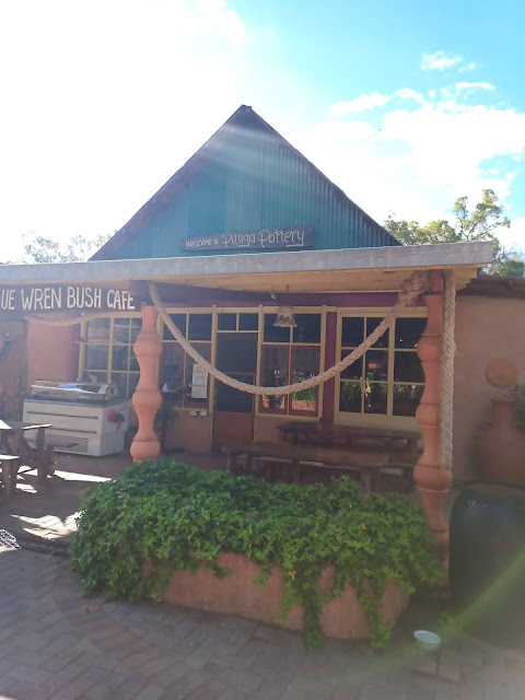
Leaving the Sandstone Caves, there is an accommodation option back in the Pilliga Forest, reached by travelling a bit further down Newell Highway and then taking a right turn to Borambitty Road. Here is the Pilliga Pottery and Barkala Farmstay, a unique farmstay experience that, due to its remote location and limited capacity, should be pre-booked. As well as accommodation, the site has a pottery workshop where visitors can purchase ceramics or take a class.
We ended our day in the Pilliga Forest with a Pilliga Farmstay. Being a Tuesday night, the cafe onsite was closed but we were able to pre-order our dinner by phone the previous day, a Margarita pizza and German meal (bratwurst, potato and sauerkraut).
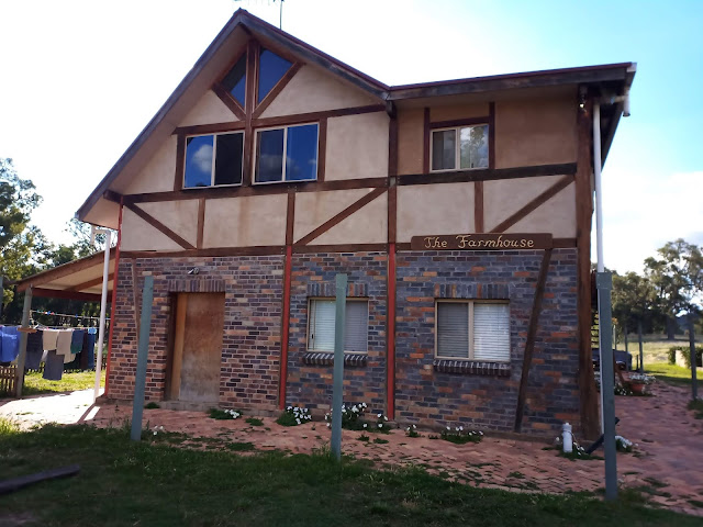
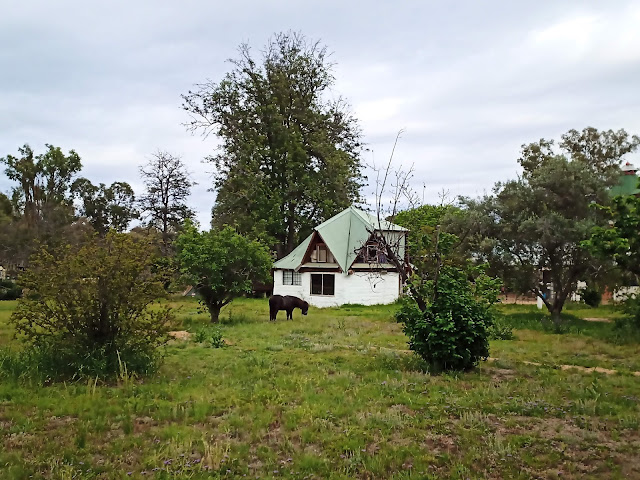
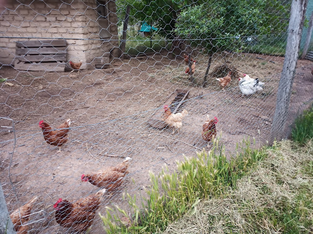
As well as providing a comfortable night's stay (we were in the Farmhouse), guests can explore walking trails around the farm and see the various animals including horses, a pony, goats, and an elusive guinea pig (who we didn't manage to see) who lives with the many chickens.
Our stay at Barkala Farmstay rounded off a nice day in the Pilliga Forest. From here, we headed to the neighbouring Warrumbungles National Park, another volcanic area in the region.







Comments
Post a Comment